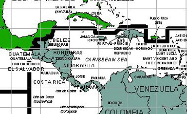
When it was drawn in 2002, the line separating the Area of Responsibility (AOR) of the new U.S. Northern Command (top) from Southern Command (bottom) bisected the U.S. Territory of Navassa Island. This was brought to the attention of both commands, and Northern Command has assumed responsibility for the island.
For the full resolution map, see here (5 MB download). The website for Northern Command is here.
Back to main page.